Mauna Ulu - Growing Mountain
Mauna Ulu is an area that we thoroughly enjoy exploring when hiking in Hawaii Volcanoes National Park. The name means "Growing Mountain" in Hawaiian. Located along the east rift zone of Kilauea Volcano, Mauna Ulu is a volcanic cone that erupted for more than five years beginning in May, 1969. It was one of the longest known rift zone eruptions of Kilauea. Huge quantities of lava up to 25 feet deep in places buried the original Chain of Craters Road, destroyed forest and grasslands, and covered 40 square miles of land as it flowed seven miles to the ocean.
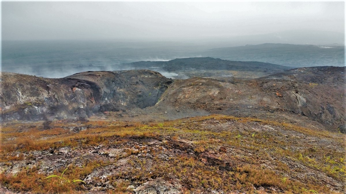
The short hike to the top, or to neighboring Pu'u Huluhulu to the north, provide a dramatic look at the somewhat apocalyptic landscape of an active volcano. Not too many years ago, this area was bubbling with an active eruption, much like what is currently taking place at Halema'uma'u.
Steam can still be seen rising through cracks along the ground. Vegetation is sparse where a vast forest once thrived. The scene is dark and barren. Harmful volcanic gasses often blow through the area. Walking gingerly across the eerie and desolate landscape, one can't help but wonder if another eruption is imminent.

Many tree molds are visible a short distance from the parking area, formed when lava flowed around trees, creating a mold of lava after the inner tree later decayed. Please protect these and other delicate lava formations.
The Route
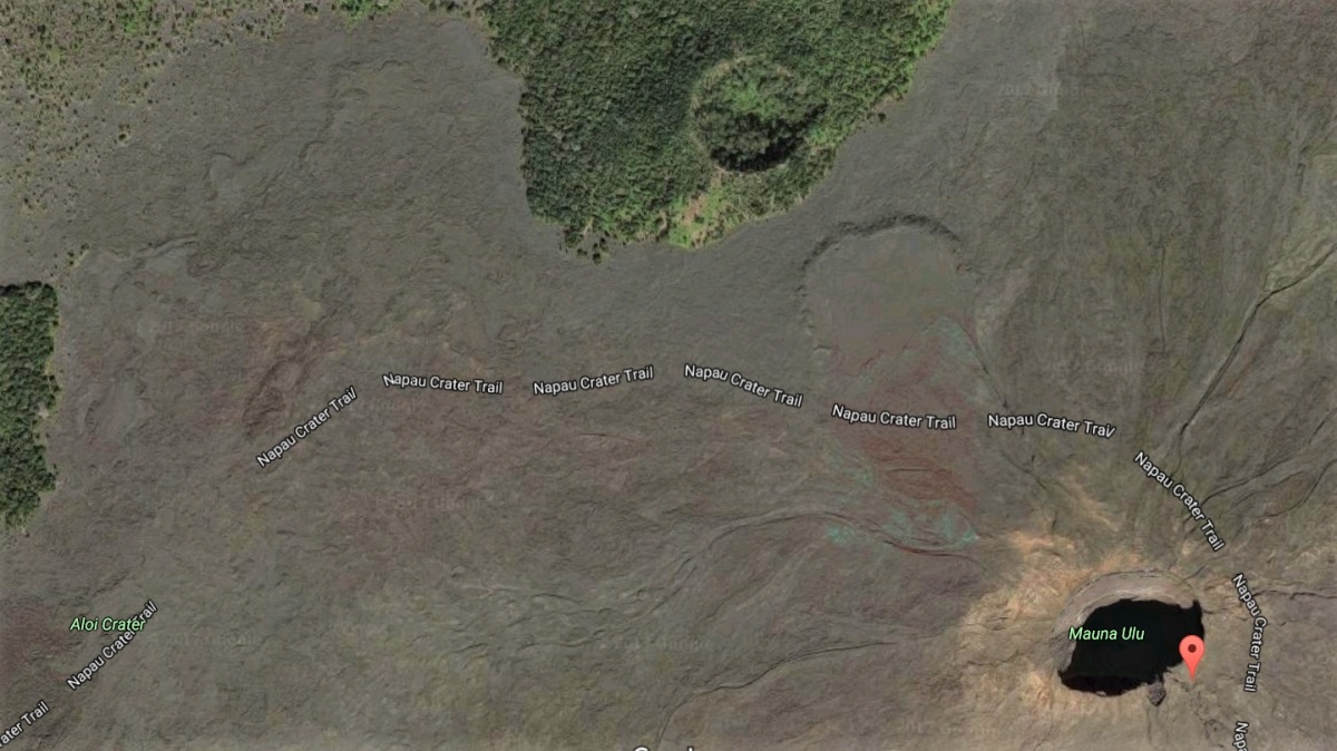
Begin this hike at the small parking area 6.5 miles (10.5 kilometers) from the Park entrance, on the left hand side of Chain of Craters Road. From the parking area, walk toward the end of the dead-end road. The trailhead will be on the left. Part of this trail essentially follows the original Chain of Craters Road that was buried during the five-year eruption. While this hike is relatively easy, certain precautions should be taken, noted below.
Follow the trail for little more than a mile. Continue past the left fork that would lead you to the top of Pu'u Huluhulu, the hillside that is covered in heavy shrubbery in the top of the image below.

You may notice there is no established trail to the top of Mauna Ulu. Ahu (stacked rocks) can provide clues of common routes, but use extreme caution as you proceed toward the top. Because this is a newer lava flow, the ground is extremely delicate, with many shallow lava tubes. Step lightly and listen for hollow sounds that might indicate that what you're stepping on could collapse.
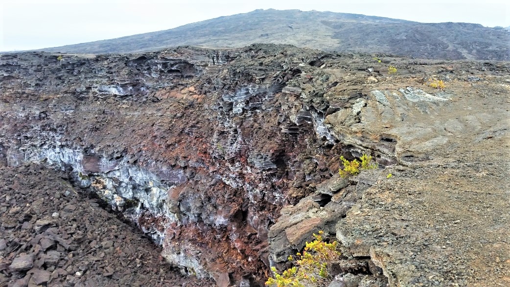
The ground suddenly falls away when you reach the top, dropping about 100 feet (30.5 meters) to the bottom of the crater. Be very careful to not walk too close to the edge of the 400 foot (122 meter) wide abyss.

Imagine this deep crater filled with liquid lava which at times produced lava fountains that exploded nearly 1800 feet (550 meters) into the air. Many other prominent pit craters were buried during the 5-year flow.
Exploring Beyond Mauna Ulu
On a clear day, you will enjoy expansive views in all directions. It is possible to see the massive Makaopuhi Crater to the east, and perhaps even plumes of smoke and gas from the Pu'u 'Ō'ō Crater.
A variation on this hike can include a short jaunt to the rim of the forested cinder cone Pu'u Huluhulu. Pu'u Huluhulu is easy to identify on your left (north) as you approach Mauna Ulu, as it is the only hill in the area with heavy vegetation. The dry lava lake that covers the valley once flowed to the base of Pu'u Huluhulu. A trail leads to the top.
For a slightly longer adventure, continue east beyond the crater summit approximately 1.5 miles (2.5k) to the rim of Makaopuhi Crater.
Like This Page?
Return from Mauna Ulu to Hiking In Hawaii
Return to Hawaii Volcanoes National Park
Return to Explore The Big Island Home Page


